Friday, 8 June 2007

Week 18 : Rio Del Mar To Glenwood Basin

Amy and I left the concrete ship of Rio Del Mar behind and headed west, hugging the coast and savouring the exotic names of the bays and beaches. Luckily, the Director of the Capitola Historical Museum, Carolyn Swift, has written a very useful article which examines the origin of these names. New Brighton Beach takes its name from the now demolished New Brighton Hotel which once stood on the spot where the State Beach is now located. Thomas Fallon built the hotel and named it after the famous British resort in the hope that it would attract a better class of customer. It didn’t, in fact it didn’t attract many customers at all and after a few years it closed down. Some years later, John Sinclair – a relative of Fallon’s – built some cabins on the beach near by. Each of the cabins was fitted with a potbelly stove and the beach became known as Pot Belly Beach. “Isn’t this fascinating”, I said to Amy as we walked along. She didn’t even grace me with a reply, merely pulled on her lead with more force than usual and returned to sniffing out the next hamburger joint.

A little further along we passed what remains of the El Salto resort which, during the 1920s was a Mecca for the California rich and famous. “The film star Mary Pickford used to holiday here”, I told Amy. Again she ignored me and pulled me ever-westwards. Some gulls were flying overhead and making a terrible racket. I tried once again to engage my travelling companion in conversation. “Did you know, that in August 1961, thousands of birds invaded the coast here at Capitola? Fresh from a feast of anchovies, the crazed birds crashed into the walls of peoples’ houses, into street signs and into trees, falling to the ground dead or dazed” Amy continued to act like she was dumb. “Alfred Hitchcock read an
article about it in the local paper, and decided to use it as material for his new thriller. His classic film “The Birds” was released two years later”. Amy indicated that the only bird she was interested in would be char-grilled, and finger-licking good.

A little later we arrived in Capitola and her spirits seemed to improve. We ate at the
Bluewater Steakhouse (“where San Francisco upscale meets Capitola-by-the-Sea local style”) and afterwards walked on the nearby beach. Capitola Beach is another area which proudly proclaims its dog-friendliness. A wonderful organisation called C-Dog (it used to be Capitola Dog Owners Group and now it is the Coastal Dog Owner Group) is dedicated to keeping this bit of the coastline dog-friendly. They have an excellent website which contains loads of very interesting information. “Did you know”, I said to Amy as we watched the sun set over Monterey Bay, “the average American dog-owner spends $203 per year feeding their dog?” Amy just gave me one of her superior smiles. Thinking of the bill I had just paid for our dinner in the Steakhouse, I understood why. We had single-handedly just pushed that average up significantly.

For the next couple of days we headed through the outer suburbs of Santa Cruz, passing the surfing beaches and neighbourhood parks. You can get an impression of what things are like by taking a look at the live Surf Cam which is operated by the
Pleasure Point Inn. But there are only a limited number of sub-drenched beaches and sun-bronzed bodies you can stare at before you begin to crave a little cultural relief, and therefore Amy and I made a short detour to call in at the Santa Cruz Museum of Natural History, a splendid little museum which has a style far in advance of its size. Currently they have an exhibition – “Illustrating Nature” - of student works from the Science Illustration Program of the University of California Extension which is well worth seeing. Even Amy enjoyed it and offered her services as a model.

When we reached the point where the San Lorenzo river spills out into the Bay we had a decision to make : to continue to follow the coast up to San Francisco or to cut inland, over the mountains, to San Jose and then to San Francisco via Silicon Valley. As someone who has had a powerful love affair with computers all my life, the choice was not a difficult one. Whistling “Do You Know The Way To San Jose”, we headed north up Buena Vista Avenue in the general direction of the Santa Cruz Mountains.
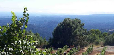

Leaving the city behind us we wound our way up tree-covered roads which twisted and turned up through the foothills. When Amy enquired where exactly were we heading for, I replied – rather enigmatically I thought, “it’s a mystery”. I could tell that Amy was beginning to fear I might be suffering from altitude sickness, but still I persisted. After carefully consulting the map I took a fork to the left, leaving the minor road behind and heading up and even more minor road. “Where the hell are we going?”. Amy was getting cross now. After a few more hundred yards she put her foot down. In fact she put all four feet down and dug them into the dirt track we were following. She refused to take another step. So picking her up – no mean feat – I carried her to the next corner and there in front of us was the sign for the Mystery Spot.

According to their
website, “The Mystery Spot is a gravitational anomaly … It is a circular area of effect around 150 feet or 46 meters in diameter. Within the Mystery Spot you will be stunned as your perceptions of the laws of physics and gravity are questioned”. As you progress through the attraction all sorts of strange things seems to be happening. When you think you are standing straight up, you appear to be leaning at an angle. Smaller things suddenly appear larger and larger things appear smaller. Poor Amy was totally freaked out by the whole experience, claiming that it reminded her of the day she managed to get her paws on an old bottle which still contained some of my prized single malt whisky.

The Mystery Spot website puts forward several explanations of the phenomenon. Perhaps it was that cones of metal were secretly brought here and buried by visitors from outer space as guidance systems for their spacecraft. Some think that it is in fact the spacecraft itself buried deep within the ground. Or maybe it is carbon dioxide permeating from the earth, a hole in the ozone layer, a magma vortex, the highest dielectric biocosmic radiation known anywhere in the world, or radiesthesia (whatever that might be). “Or maybe its because they have erected all the buildings at a funny angle so as to earn a dollar or two from passing idiots with more money than common sense”, sniffed Amy as we left the spot behind and headed north. “Cynic”, I shot back. “Fool”, she retorted.

We kept on like this as we scrambled through some thick brush, taking an unofficial shortcut back to the main highway. We didn’t make friends until we got to Scotts Valley where I bought Amy a double helping of chicken nuggets from the McDonalds there. I also stocked up at the shop and made sure we had enough food and drink for a few days. We were about to leave civilisation behind and head into the mountains. Taking a last look back at Monterey Bay, we headed north. Once again I bravely whistled “Do You Know The Way To San Jose”. Amy barked at the appropriate point.

Friday, 1 June 2007

Weel 17 : Moss Landing To Rio Del Mar


Amy and I left Moss Landing and headed north, soon crossing over a river which – as far as we could work out – must be the Pajaro. In an effort to be more precise we turned to the website of the Moss Landing Harbor District (“our mission is to provide a functional, visitor-friendly harbour for commercial and recreational use"). Unfortunately, their mission didn’t extend as far as telling me which river flowed through their wharfs, but before I could lodge a complaint I noticed that I should have had a $5 dog permit to walk Amy anywhere near the harbour. As Amy pointed out, you can buy a lot of chicken for $5, so we decided to leave town quick and head for the County Line.

County lines are one of my great discoveries of this walk. If you fly, county lines are meaningless, if you travel by train they are trivial. If your chosen method of transport is a fast car they fly by without troubling either the conscious or the subconscious. But if you walk, they take on a real significance. You look forward to new counties with a pleasing anticipation, you think back on old counties with satisfied nostalgia. And so – halfway between Moss Landing and Watsonville – it was goodbye to Monterey and hello to
Santa Cruz (“our beaches are just the beginning…”), the second-smallest County in California. By a tradition which stretches back to the beginning of February 2007, the crossing of a County Line means that Amy and I change our virtual environment. So for the next week or so we will be reading the Santa Cruz Sentinel and listening to the quite wonderful Free Radio Santa Cruz.

Our first chance to see what Santa Cruz County was really like was when we arrived at the City of Watsonville. “Watsonville is the strawberry capital of the world”, I explained to Amy as we walked towards the city-centre. “Each year they hold a famous
Strawberry Festival”, I continued with a creeping feeling of déjà vu, for didn’t we have the same conversation about Castroville and artichokes just last week. “And did you know”, I continued like someone in need of a life, “that just down the road is Salinas which is the lettuce capital of the world, whereas just over there is Gilroy which is the garlic capital of the world”. Amy feigned indifference, but I knew that she was mentally plotting a route to Gainesville, Georgia (before you dash off to look it up, it’s the chicken capital of the world).

Watsonville looks like a pretty cool place. It has a
speedway track, a famous high school soccer team, and …. and it’s for sale for just $4,000. Well, Watsonville.com is for sale, and when you live in a virtual world it’s the same thing.

The walk from Watsonville to the coast at La Selva Beach takes you past field after field of strawberries. Every so often Amy and I would stop to sample the fare, thanking the powers that be that we were in Watsonville and not Castroville (the thought of chewing on a raw artichoke was too much for either of us). La Selva Beach is a sleepy little place. “What fun things are there to do here”, I asked myself. Then I checked the on-line
La Selva Beach Forum and discovered that someone else had posed the same question almost two years ago. They are still awaiting a reply. Not having that kind of time to spare, Amy and I headed north to Rob Roy Junction.

Now there’s a name to conjure with”, I said to Amy as we walked up San Andreas Road (which we later learnt was named after the fault which ran underneath it). Men in tartan kilts sweeping down from mist covered moors to the sound of bagpipes. When we eventually got there we were disappointed. The emphasis was very much on the “Junction” rather than the “Rob Roy”. Amy muttered something about the Trades Description Act as we climbed the concrete ramparts that kept the multiple lanes of traffic apart, but I reminded her that the same criticism was made of Sir Walter Scott’s book – in which the celebrated Rob Roy is only a minor character - some 190 years ago.

We walked the concrete highway to Aptos which, in native American, means “where the waters meet”. Amy stopped next to a fire hydrant to celebrate the fact. Not wanting to be left out of the litany of world famous Californian cities and not growing very many pomegranates or loganberries, Aptos styles itself as “the home of the World’s Shortest 4th July Parade”. It appears that the Aptos parade is just under half a mile long, which – I am reliably informed - is on the short side for such affairs. Nevertheless, half a mile is still quite a long way and therefore, the way is open for any other municipality to steal Aptos’ crown. Aptos is also famous for its French restaurant – the
Café Sparrow. As soon as I mentioned this to Amy she got quite excited and demanded that we stop there for lunch. She thoroughly enjoyed her sparrow burger and ate most of mine as well. Despite being assured that the sparrow in the burger was in fact a chicken, I couldn’t get the thought of a little hopping bird out of my mind.

Our week came to an end just down the road from Aptos at the seaside community of Rio Del Mar. Like many other American CDP’s (census designated places), there is a mass of statistical information about Rio Del Mar (median age - 44, median income - $87,000, median race – nine-tenths white with a dash of black, native American, Chinese, and what-have-you) but very little insight into its soul. We wandered through the streets in search the essence of the place, its defining characteristics, or – as those business types would say – its USP (Unique Selling Point). It wasn’t until we came to rest at Seacliff State Beach that we discovered it. It has a concrete ship!

The S.S Palo Alto was an oil tanker built during the First World War. Steel was expensive and someone had the bright idea that building a ship out of cement might give it better protection against German submarines. But the War came to an end, before the construction of the ship did, and by the early 1920 its owners discovered that they had got themselves a classic white elephant. In 1921 it made its first and only journey from Alameda, where it was built, across the San Francisco Bay. For a time it served as a static oil storage tanker and then, in 1930, it was bought by the Seacliff Amusement Corporation. They built a wooden pier to connect the ship to the beach and had great plans for converting it into a luxury Oceanside amusement centre. But then along came the depression and the great concrete ship slowly decayed and died. Strangely enough, the S.S. Palo Alto has now become a tourist attraction in its own right. You can walk the beach and gaze at the sunken concrete hulk. It’s not what the Seacliff Amusement Corporation had in mind, but it got there in the end.

Sunday, 27 May 2007

Week 16 : Monterey To Moss Landing


As Amy and I walked down from the Presido of Monterey to Fisherman’s Wharf after spending a somewhat uncomfortable night on a park bench I whistled “It Happened In Monterey” to keep her spirits up. Stopping to check the lyrics and noticing the line “I met her in Monterey, in old Mexico” I realised I had made a mistake. That was another Monterey, that was another country. It’s a bit like that Monterey – Monterey, California that is – it’s a surprising place and even a bit of a confusing place at times.

For example, as we were taking a shortcut from Arbrego Street to Pacific Street we passed “
Stevenson House – the Home of Robert Louis Stevenson”. Could this be the same Stevenson, the archetypal Scotsman, the creator or Treasure Island and Kidnapped? Could this be the sickly son of the famous Stevenson family of lighthouse builders? The answer is, of course, yes. Stevenson stayed here in 1879 (just for a few months be never let it be said that Americans don’t know how to make the most of the history they have) to be near the love of his life and his future wife, Fanny Vandergrift Osbourne.

The literary surprises continued as we hit the seafront just north of Fisherman’s Wharf and discovered a flashy collection of shops, bars and restaurants that is the 21st century
Cannery Row. The old fish canning plants that formed the heart of the area that Steinbeck wrote about so memorably are long gone, replaced by designer outlets and theme bars. As Amy remarked, “that’s progress”.

Progress is less noticeable amongst the picturesque chaos that is
Fisherman’s Wharf. Here you will find a hotchpotch of shops and restaurants strung out along the wooden piers. During the height of its commercial power, Monterey was one of the most important fishing ports in California and the centre of the sardine industry (it was sardines which were packed by the Cannary Row plants). Originally built in 1870, part of the main pier collapsed in 1923 under the weight of 20,000 cases of sardines which were waiting to be shipped out. To get a flavour of the wharf today, have a look at one of the holiday videos available on YouTube. Although the sardine industry came to a fairly sudden end in the late 1940s when the shoals of sardines fell victim to over-fishing, you can still catch the tang of fish-scales in the air. All that fish can be a bit overpowering, so Amy and I bought a couple of burgers to eat as we made our way around Monterey Bay.

Main course over with, we began to think about something to round our dinner off. Amy quite fancied donuts but I reminded her of the whole purpose of our coast-to-coast walk and suggested something healthy like fruit instead. At which point we serendipitously arrived in the Monterey suburb of Del Monte. So what were the links between this sleepy suburb and the world-famous food company? Were we in for another Monterey surprise? There were clearly no vast canning warehouses here, nor any food processing plants. A visit to the Del Monte
company website told us that the headquarters of the company were situated to the north in San Francisco. But the history pages on the website gave us the origin of the Del Monte brand name. It was first used in 1886 for a premium brand of coffee which was supplied to the fashionable Del Monte Hotel in Monterey. The hotel is long-gone – repeatedly attacked by earthquake and fire - and on the site today is the Club Del Monte which styles itself as “the Queen of American Watering Places”. It is now operated by the Navy’s Morale, Welfare and Recreation Department. From their website, it was unclear whether they still served Del Monte tinned fruit, so we gave it a miss and continued up the Bay.

The military theme continued as we made our way north. This is what used to be Fort Ord, one of America’s biggest military bases. It was from here that thousands of troops were shipped off to Korea and Vietnam. As long as you weren’t en-route for combat, Fort Ord was seen as a good posting with its close proximity to the Californian beaches. The site of the military base was taken over by California State University, Monterey Bay in 1994 when Fort Ord closed down. And now the young people who graduate from this sun-kissed corner of California go on to more peaceful destinations.

Monterey had one last surprise for us. We spotted a poster for the
50th Monterey Jazz Festival which will take place in September 2007. The poster was headed MJF and was clearly for a jazz festival. Back home in West Yorkshire, when I am not walking Amy around the rainy streets, I help with the organisation of the Annual Marsden Jazz Festival (MJF) which takes place in a village on the edge of the moors. Could our fame have spread this far? But as I read the list or artists appearing at the American version of MJF - Diana Krall, Ornette Coleman, Sonny Rollins, Dave Brubeck – I knew I was either day-dreaming again or dealing with a very different festival. I comforted myself with listening to Diana Krall’s latest CD on my MP3 player. After all, recorded music must have been the first example of virtual reality. If Edison had not opened the door to the virtual concert, and pushed the boundaries of technology backwards, perhaps Amy and I would not have been virtually walking the streets of Monterey 130 years later.

When we had been planning our week’s walk a few days earlier, I had drawn Amy’s attention to the town of Castroville and told her we must pass through there. It would be a good joke, visiting a town which appeared to be dedicated to modern Americas’ greatest enemy. I could write something funny in the Blog about it. But the joke was on me. When Amy and I arrived in the town we found not a joke but an artichoke. What we had failed to realise – silly us – was that Castroville styles itself as the “Artichoke Centre of the World” and our visit coincided with the 48th Castroville Artichoke Festival. What a time we had. There was a parade, there we agro-art exhibitions and there were demonstrations of how to cook artichokes. It is a little known fact – other than to people who have spent a couple of days in Castroville during the Festival – that there are hundreds of delicious ways to serve artichokes. A few of the recipes can be found on the
Festival website. Amy and I did try a bag of French Fried Artichoke Hearts and then quickly left town feeling ever-so-slightly queasy.

Our week finished back on the coast at Moss Landing which is described by its Chamber of Commerce as “a quaint, historic fishing village that is full of hidden treasures and enjoyable activities”. Other than the rather ugly power plant and the mud-banks, it was. No surprise there then.

Monday, 21 May 2007

Week 15 : Bixby Bridge To Monterey


There seemed to be a spring in the step of Amy, my soft-coated wheaten terrier, as we embarked on week 15 of our epic journey. Perhaps she could smell civilisation: maybe the salt-encrusted aroma of chicken nuggets and fries was wafting south down the Big Sur coast. Perhaps she had detected another colony of elephant seals. But she was pulling on her leash as we left Bixby Bridge behind us and she provided a little extra motive force as we crept north past the coves, canyons and points in our journey towards Monterey.

We stopped for a late breakfast at the spectacular
Rocky Point Restaurant where I was tempted by the Le Roc Corsaire’s Treasure (New York steak and two eggs any style served with country potatoes, black beans, sourdough toast, coffee and fresh orange juice. … all for $23.00) whilst Amy polished off a Buccaneer’s Bounty (Chicken/apple sausages or bacon, three eggs any style served with country potatoes, sourdough toast, coffee and fresh orange juice). I took the advice of the menu and started the day with a glass of champagne and then I started Amy’s day by downing another in her honour. When we set back on our way up Highway One, I was more grateful than ever for the constant pulling of my travelling companion which allowed me to doze and walk at the same time. We were still out in the open countryside – it has now been a good few weeks since we had passed through anything larger than a village (what the Americans call a city). This meant that every time you came across a building of any significance you were anxious to identify its purpose, its history and its secrets.

Thus, on our second day out, when we spotted a group of buildings marked MPSL – clinging to the strip of land between the road and the sea – we were anxious to find out more about them. Amy and I played guessing games. I suggested Missile Propulsion Strategy Laboratory. Amy went – I thought somewhat optimistically - with Meat, Poultry and Seafood Left-overs. In fact we were both wide of the mark, for this was the
University of California Marine Pollution Studies Laboratory. Delving into the background of the Laboratory it turned out that Amy and I were not too far out with our guesses. The facility was first build as a missile tracking station by the US Navy, and later became a research base for the infant aquaculture industry. Now it monitors pollution levels in both sea water and fresh water : its local pollution-free sea and rivers providing an excellent control for research purposes.

This feeling of being at one with nature was the theme of the first part of the week. Soon we entered the 3,000 acre
Garrapata State Park where “spectacular rocky shorelines play counterpoint with an inland area of steep mountains and deep redwood canyons” The usual Warning Notices from Governor Schwarzenegger said that dogs weren’t allowed in the State Park - other than, in this case, on the road or on the beach – so we had to give the coniferous forests, the Californian Brome and the blue wild rye a rain-check. However, down on the beach we did see some brown pelicans – still quite rare in these parts – and a quite amazing plant which was – we were told - sea lettuce (Dudleya caespitosa).

A little further north we came upon Carmel Highlands and, feeling in need of a little luxury for a change, we were tickled pink to find the
Tickle Pink Inn just off the main highway. The enchantment from the natural beauty, we are promised, “captivates your senses and sets a mood which will nurture, renew, and inspire”. The name comes from the fact that the site was originally the home of State Senator Edward and Mrs. Bess Tickle. A great lover of flowers, particularly pink varieties, Mrs. Tickle liked a suggestion to name their hillside stone cottage 'Tickle Pink'. The stone cottage has since disappeared but the name remains. Unfortunately, the Inn is another of those places where dogs are not welcome, so I had to smuggle Amy in in the usual fashion. Having a somewhat overweight long-haired terrier concealed under your pullover gives a whole new meaning to “tickled pink”.

This discrimination against my travelling companion was maintained at our next stop on our journey northwards to Monterey – at
Point Lobos State Reserve. Despite the fact that the name translates as Point Of The Sea Wolves, this is not a canine-friendly place and dogs are not allowed anywhere within the confines of the Reserve. So I apologised to Amy and walked on by. This "greatest meeting of land and water in the world" would have to wait for another visit. I feared that Amy might be getting a little upset by this constant rejection, but her spirits remained high, and she was still pulling enthusiastically. As we entered the wonderful city of Carmel-by-the-Sea, I at last understood why. Not only is this spot rated as one of the top ten destinations in the United States by Conde Nast Traveler, not only is it one of the favourite resorts of A List celebrities, not only has it become a Mecca for poets, artists and academics, …. it was recently voted the most dog-friendly city in America.

Wander the delightful streets and you are greeted with signs declaring “Dogs Welcome”. The city authorities produce long lists of all kinds of establishments where man and dog can enjoy life together, side by side in a spirit of harmony and equality. Dogs are allowed on the streets, in the parks on the beach and in the City Hall. There are dog-friendly restaurants, hotels, inns, and shops of all types. There are shops that specialise in clothes for dogs, food for dogs, furniture and fittings for dogs. Amy wandered around with a big smile on her blond furry face. She was in Carmel-by-the-Sea. She was in paradise.

It was hard dragging Amy away, but I wanted to get over the hill and in sight of Monterey before the end of our week. I eventually reached a compromise with her – our continued journey north in exchange for an all-expenses trip to the
Diggidy Dog Boutique (it’s a kind of Harvey Nichols for Dogs). After looking around for what seemed like hours she finished up with some Earthbath Deodorizing Spritz ($9.95), a Wrought Iron Antique Rust Feeder Station ($78), and a Bow and Fur Leather Coat ($72).

As we walked north from Carmel and into the outer suburbs of Monterey, I reflected on the beauty of the California coast, the friendliness of its people and the delights that were yet to come. As for Amy, I am not sure what she reflected on. But she had a smile on her face and a batch of Carmel real estate brochures clutched tightly in her paw.

Friday, 11 May 2007

Week 14 Julia Pfeiffer Burns SP To Bixby Bridge


“Amy and I walked along the poor haunted canyon, under the bridge and came to where those heartless breakers burst in on the sand. The gusts of wind tore the leaves from the trees and plunged them into the surf where they were belted and melted and taken off to sea”.

If that sounds like Jack Kerouac, it’s meant to. Amy and I are walking up the Big Sur coast in California, past the spot where Kerouac came to escape the city and his demons. This is also the coast of drifters and dreamers, artists, craftsmen and the occasional Hollywood star searching for peace and tranquillity.

Our week started at the Julia Pfeiffer Burns State Park (JPBSP). You could put forward a reasonable case for renaming this bit of the Californian Coast Pfeiffer County as the Pfeiffer family were early pioneers and are well represented in local place names. As well as the JPBSP there is the Pfeiffer Big Sur State Park, Pfeiffer Beach, the Pfeiffer Resort and no doubt a brace of Pfeiffer creeks. The original Pfeiffer Resort – the term “resort” was given a fairly liberal interpretation by the Pfeiffers was established in 1902 by John and Florence Pfeiffer. John was an untrained naturalist with am interest in the study of local plants, coastal weather patterns and the habits of birds and animals. The family supported themselves by a combination of subsistence farming, beekeeping, ranching, logging and providing hospitality to visitors. The State Park where we started out from this week was named in memory of their daughter Julia, who maintained the family tradition of being passionately interested in the local flora and fauna.

Just north of the JPBSP we found Castro Canyon – how the name must annoy some righteous Americans – and there we found the wonderful
Deetjen’s Big Sur Inn. The website has a whole section on the history of the Inn – which dates back all the way to the 1930s (Americans do so well at making so much out of so little history, and that is not meant as a criticism) – and the Inn is on the National Register of Historic Places. It was founded by Helmuth Deetjen and his wife Helen and quickly benefited from the opening of the then new Highway 1. Over the years “Grandpa Deetjen” as he is now known, added rooms and wooden lodges built in the style of his native Norway. The Inn, which is now run by the non-profit making Deetjens Big Sur Inn Preservation Society, is dedicated to maintaining an enclave of peace and quiet in the busy modern world of California. They boast with pride that mobile phones won’t work in the area, there are no phones or televisions in the rooms, and room doors lock only from the inside. Our stay at the Inn was complicated by the fact that pets are not welcome (this is despite the fact that the Inn proudly displays several photographs of Grandpa Deetjen with his favourite dogs). Amy claimed that this was crass hypocrisy. As I sneaked her into my room hidden beneath my anorak, I told her to shut up.

This whole stretch of coast is dotted with inns, hotels and restaurants of a similar antiquity and in equally attractive surroundings as the Big Sur Inn. A little further up the coast is the Nepenthe Restaurant which has its own
webcam so you can get a feel of the atmosphere. At the adjacent Café Kevah, Amy and I enjoyed one of their famous sticky buns ( you can download the recipe from their website) as we took in the view of the coast and the mountains.

Just before stopping for our sticky bun, we had paid a call on the Henry
Miller Memorial Library. Miller lived on the Big Sur coast from 1944 until 1962 and wrote some of his most famous books here. At the Memorial Library you can see the usual memorabilia, but the Library also makes a good stab at being more than just a mausoleum to a long-dead writer. They have an active programme of events featuring a wide range of artists and musicians. As we walked north I explained to Amy that, according to Miller, when we reach for a book we are hoping to meet “a man of our own heart, to experience tragedies and delights which we ourselves lack the courage to invite, to dream dreams which will render life more hallucinating, perhaps also to discover a philosophy of life which will make us more adequate in meeting the trials and ordeals which beset us”. She didn’t sound very impressed and said hat she liked a good story herself.

The Big Sur is the name of the region, the name of the coastline, and the name of a clutch of local garages, bakeries, and galleries. Many mistakenly think that the Big Sur is the large volcanic rock outcrop on top of which the Point Sur Lightstation sits. This is not the case. The name comes from the Spanish name for the region “el país grande del sur” which described what was then a largely unexplored region to the south of Monterey. You can get a good taste of what the Big Sur has to offer by looking at the excellent
Big Sur Guide which is published by the Big Sur Chamber Of Commerce.

The Lightstation is a noble building which forms the focal point of
Point Sur State Historic Park. Sitting 361 feet above the surf on a large volcanic rock, Point Sur is the only complete turn-of-the century Lightstation open to the public in California, and is on the National Register of Historic Places. First lit on August 1, 1889, the lighthouse has remained in continuous operation. Lighthouse keepers and their families lived at the site from 1889 to 1974 when the lighthouse was automated. The only way to visit the Lightstation, and indeed the rock itself, is to go on one of the official tours. But like too many things in this part of the world, dogs are not allowed. They do run moonlight tours and for a while Amy and I did consider the old dog hidden under the anorak approach, but decided against it. A quick look at the Wikipedia entry for the Lightstation told us all we could reasonably want to know (the light gives a white flash every 15 seconds whilst the fog signal is a group of two blasts every 60 seconds - blast two seconds, silent one second, blast three seconds, silent fifty-four seconds) so we sat and ate the last of our sticky buns instead.

We followed the road to the north of Point Sur, heading for the point which would mark the end of our wanderings for this week – Bixby Bridge. There is an admirable academic paper on the building of Bixby Bridge available on the
Pelican Network website. I got quite enthusiastic about the mechanics of it all and explained to Amy that the bridge was constructed to withstand a stress (f) at the mid-point where f = H = 1530666.5 = 472.4 psi A 3240*. Once again, Amy was less than impressed and simply looked over the side of the bridge and picked the remaining bits of sticky bun from between her teeth.

Thursday, 3 May 2007

Week 13 : Gorda To Julia Pfeiffer Burns State Park


It is week 13 of our epic trans-American journey. Amy, our soft-coated wheaten terrier, and I are attempting to walk from Los Angeles to New York in easy stages (very easy stages). If you have just joined us – where have you been for the last thirteen weeks? – I should explain that we aren’t really walking from one side of the American continent to the other. It is an exercise in virtual reality. Amy and I walk the streets of West Yorkshire but plot the miles on a map of America. The sights, the sounds, the smells we describe all come from the virtual world of the internet. Now that we have got that out of the way, read on.

This week we walked up what must be one of the most beautiful coastal roads in America – taking Highway 1 up the Big Sur Coast. Our most useful guide has been the very comprehensive website “
A Guide To California’s Big Sur” which has been put together by a guy called John Rabold, partly for his own amusement, partly as a public service for visitors, and partly as a way of making the occasional dollar. I like the approach. It is one that I am getting used to as I tramp the virtual trails of America. Whilst the big media and publishing companies control the maps and guidebooks that are the companions of the real-time traveller, us virtual travellers inhabit a different world, a world in which the amateur, the enthusiast and the eccentric still have a central place. Long may it continue.

A few miles north of Gorda there is a sign at the side of the Highway pointing the way to Jade Cove. Unsurprisingly, the cove gets its name from the deposits of jade which can often be found here. Thinking that a bit of jade might make a nice present to take to the folks back home, Amy and I carefully read the
regulations relating to the collection of jade and headed down the path. Noting that the restrictions did not cover dogs digging for jade, I cleverly whispered to Amy “chicken” and pointed to the mass of rocks that littered the beach. After half an hour I hadn’t found any jade – and Amy hadn’t found any chicken – so we continued northwards.

This stretch of the coast is just a succession of quite stunning coves and rocks. You can get an idea of what the scenery is like by looking at the
Big Sur panorama which is available on the iNeTours website. But after a few days of this, it was concrete and tarmac I became obsessed with. Midway through the week we came upon a road junction and – in these parts – this is a special event. My maps had told me that going straight on would keep me on the coast on Highway 1, past Point Sur and heading for Monterey. Turning right would take me on the splendidly named Nacimiento-Fergusson Road over the Santa Lucia mountains to King City, Salinas and all points north. Now Amy was in favour of staying on the coast – something about elephant seals but I decided it would be best not to pursue that too closely – whilst I quite fancied the mountains. When we got to the junction and saw the Nacimiento-Fergusson Road climbing up the steep mountainside like a stairway to heaven my mind was made up. We stuck to the coast road.

A few miles further north, the coast road passes through Limekiln State Park. The Park and its road are a monument to civil engineering. The virtual presence of the park is a monument to that wonderful digital skill, cut and paste. Google Limekiln State Park and follow up any of the hits and you are almost sure to find the same descriptive sentence. I don’t want to swim against the trend, so here it is : “The park features breathtaking views of the Big Sur Coast, the beauty of the redwoods, the rugged coast and the cultural history of limekilns”. The original author is probably lost in the mist of digital antiquity but hopefully, he or she still feels a virtual glow every time the phrase is used. The
California State Parks website has some nice photographs of the park, but our attempt to investigate it more fully were curtailed by the usual prohibition on dogs on State Park trails. On questioning the reason behind this prohibition we were given a leaflet signed by Arnold Schwarzenegger. I explained to Amy that he was a seriously big man. We decided to stick to the road.


Just north of the State Park is the tiny community of Lucia. Most sources claim that this small collection of houses is named after the nearby Santa Lucia mountains. However, according to the website of Lucia Lodge (spectacular deck dinning - a great spot to relax with a cocktail while enjoying a stunning view of the Big Sur coast) it was named after the postmistress who, in turn, had been named after the mountains. Further north still the road passes John Little State Reserve. I am unsure of the correct terminology here. Is a State Reserve a State Park which hasn’t grown up, or a State Preserve you can’t get the lid off. Being afraid that I might upset Governor Schwarzenegger, I hurried on by.

It was a few miles north of here that our week came to an end. We had reached yet another State Park, this time the Julia Pfeiffer Burns State Park (this is all very confusing because there is another park called the Pfeiffer Big Sur State Park a few miles further north. Anyway, our Pfeiffer Park has a path leading down to the spectacular 80 foot McWay Waterfall. Once again, dogs are not allowed down the path – indeed humans are not allowed down onto the beach. But this time Amy and I both said to hell with Big Arn. This is the virtual world after all. So down we went. And believe me, the risk is worth it.

Friday, 27 April 2007

Week 12 : Hearst Castle To Gorda


Dogs aren’t allowed on the tour of Hearst Castle. This is a little odd seeing that old WR (having paid my $24 dollar entrance fee I feel that a degree of familiarity is warranted) was fond of animals. During the 1930s, herds of giraffes, lions, elephants and zebras would wander around the grounds, and, as we saw the previous night, some of the zebras still remain. In many ways, William Randolph Hearst was the spiritual godfather to Michael Jackson. Nevertheless, in order to take the tour, I had to leave Amy behind which, given her temperament, is always a bit of a risk. I left her down by the Pacific Coast and she promised to just sit and watch the elephant seals and wait for my return.

Hearst Castle is well document in both the traditional and the digital media. If you want to get a flavour of the conducted tour, there is a honest little video taken by skcarterr available on
YouTube. If you want to see some superb images of the Castle have a look at the photo gallery on the Hearst Castle website. If you want to know about WR then a good starting point is his entry in Wikipedia. However, you can get quite a good idea of the chap by looking at the Editorial Guidelines he circulated to all his 28 newspapers in 1933. Number 1 is “Make a paper for the nicest kind of people for the great middle class. Don’t print a lot of dull stuff that people are supposed to like and don’t”. Number 2 is even better : “Omit things that will offend nice people. Avoid coarseness and a low tone”.

For someone who was such a consummate showman and a first-class manipulator of twentieth century media, it is somehow appropriate that his lasting legacy is a fake castle and a razor-sharp movie. Hearst Castle looks stunning perched on the hills above the Pacific coast. But it is made of reinforced concrete to withstand the earthquakes and its treasures where shipped over from a bevy of European Stately Homes. The movie was, of course, Citizen Kane – the story of a megalomaniac newspaper publisher which is still rated by many people as the greatest film ever made. Whether it was the greatest movie ever made and whether it was a true portrayal of Hearst were questions rumbling around my mind as the tour bus brought me back down “the enchanted hill” to the visitors centre.

I found Amy (did she have a guilty look on her fine wheaten-blond face?) and we followed Highway 1 north, leaving Hearst Castle, San Simeon and the south central coast of California behind us. For the next two or three weeks we were leaving much of what, in California, constitutes civilisation behind. As far as I could see from the map, for the next eighty miles there would be no fast-food restaurants and no shopping malls. There would, however, be plenty of elephant seals.


I caught my first sight of these magnificent animals a few miles north of San Simeon at the Piedras Blancas Elephant Seal Viewing Point. Truth be told, as soon as they saw Amy most of them made a dash for the open sea which made me somewhat suspicious of her activities whilst I was doing the Castle Tour. However, you can enjoy the full elephant seal experience – including the sound of them honking and barking at each other – on the
Friends of the Elephant Seal website. For those captivated by these animals a visit to the National Geographic’s live Seal Cam is essential.

Just north of the seal colony is the Piedras Blancas Lighthouse, one of only three lighthouses built on the Californian coast. It was built to guide ships safely into San Simeon Bay which in the middle of the nineteenth century was a centre for the whaling industry. According to the wonderful
Lighthouse Friends website, the whaling station was built “to surprise the huge creatures as they hugged the nearby shoreline during their annual migration”. It all sounds a bit beastly to me, but Amy casts a knowing look out to the open sea. I have a feeling that I know what she will be dreaming about tonight.

Over the next few days the road north takes us over the County Line. We leave behind San Luis Obispo County and enter Monterey County. Before I embarked on my virtual journey, I had little idea of the existence of counties in the United States. Like all half-decent pub quiz players, I could name most of the States and a sprinkling of State capitals. But the concept of a County (and American County that is) was foreign to me. But as I walked on I became more familiar with counties and county lines : they would act as useful yardsticks, handy reference points and emotional bookmarks. So Amy and I said farewell to SLO (as those who have walked its streets call it) and hello to Monterey, home to half a million people and one of the original counties of the State of California.

For the rest of the week we walked north along State Route 1 (Highway 1 to those who have walked its tarmac) which must be one of the most beautiful coastal roads in the world. It has been designated an “All-American Road” (one of only 27 in the USA). The designation means they have features that do not exist elsewhere in the United States and are scenic enough to be tourist destinations unto themselves.

By the end of week 12 we had reached Gorda (the official maps call it Gorda, the web-based spin-doctors call it Gorda Springs-by-the Sea). Whatever you call it, it is a couple of houses a shop and a café. According to the
Beach California website, Gorda’s Whale Watcher Cafe is “a world renowned establishment offering a 60 year tradition of hospitality and gourmet dining in a romantic, nautical-like setting”. World-famous or not, Amy and I settled down at the end of the week, looking out to sea, watching out for whales swimming by.